Submarine Cable Map Logo

Submarine Cable Map

Submarine Cable Map is TeleGeography's comprehensive and regularly updated interactive map showcasing the world's major submarine cable systems and landing stations. It provides detailed visualization of underwater cables, their ownership, and landing points, serving as an essential resource for telecom professionals, researchers, and enthusiasts interested in global internet infrastructure.

platform:web pricing:free feature:interactive-map feature:data-visualization feature:real-time-updates feature:geospatial target:researchers target:telecom-professionals target:students use-case:infrastructure-mapping use-case:network-analysis

Features

Interactive Map
Data Visualization
Real Time Updates
Geospatial

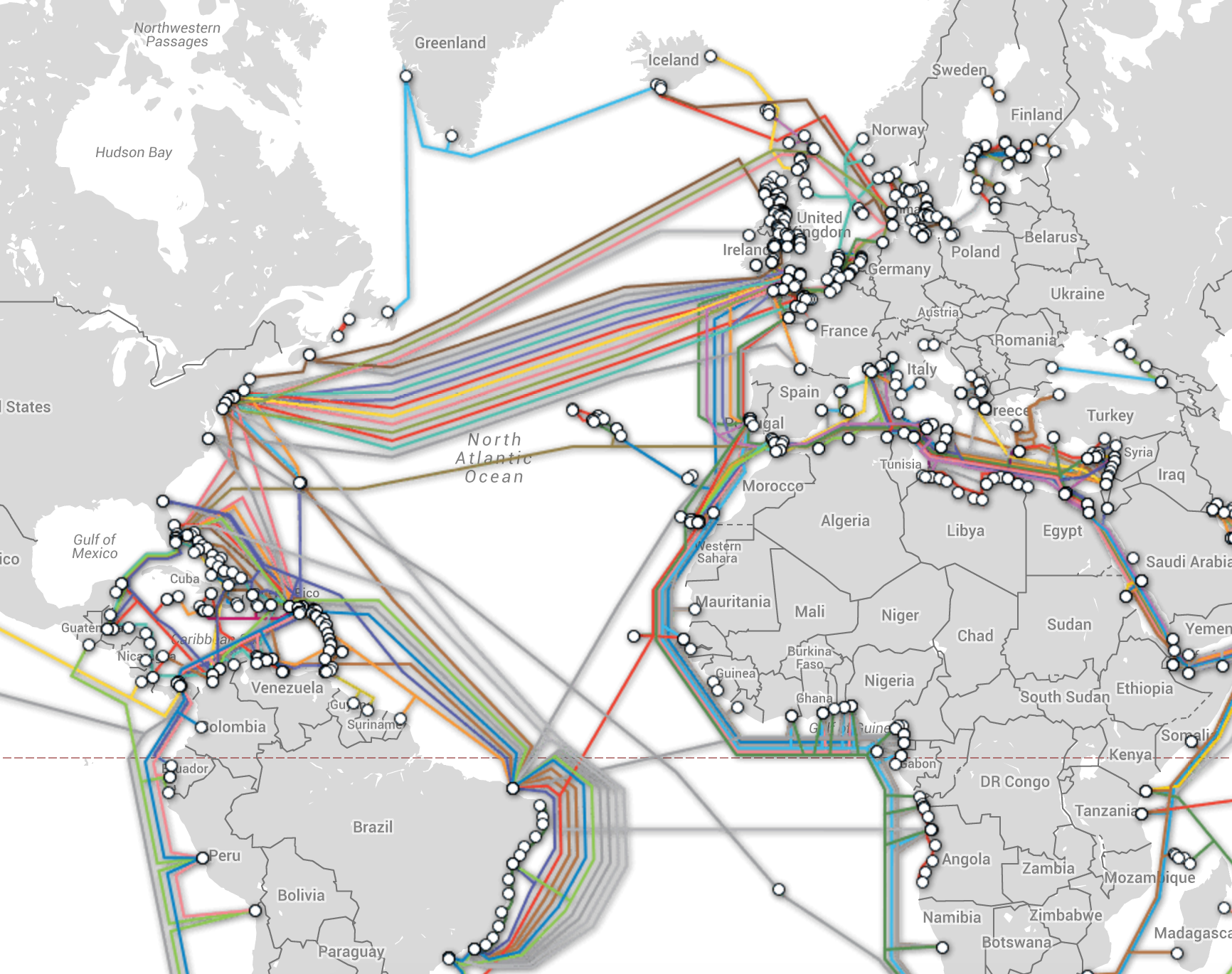
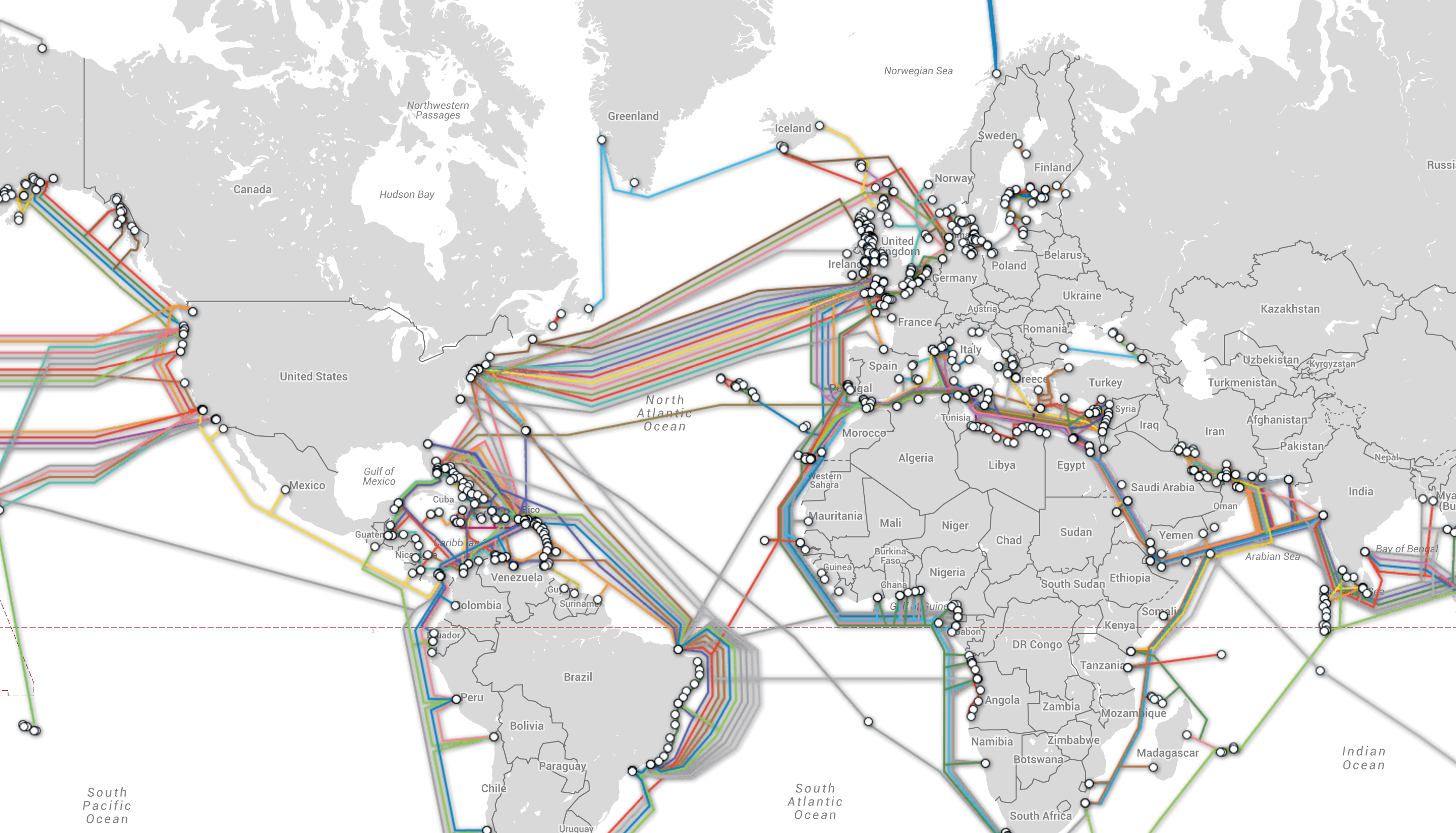
Images & Screenshots

Submarine Cable Map Image

Testimonies

No testimonies available for this tool yet.

Basic Info
  • Category Maps
Availability & Pricing
  • Pricing Model
    Free
AI Curation
  • Related Tools Agent detected 10 related tools for

    6 months ago

  • Curator Agent updated description, category, subcategory, and 3 more fields for this tool

    7 months ago